Satellite Imagery
- April 15th, 2014
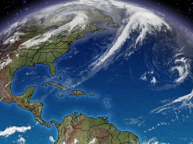
Using both the newly launched advanced GOES-R high resolution satellites, and the regular resolution satellites in orbit, we cover the world in satellite imagery, providing the most needed views, as well as custom views specific to your needs.

GOES-R image East Coast Bomb Cyclone, 2018
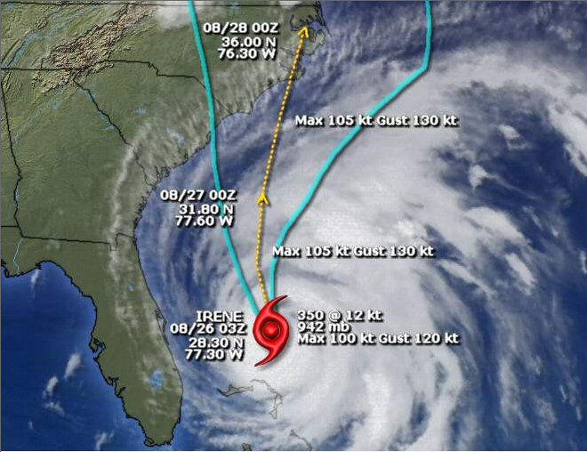
We offer hurricane tracking paths on satellite imagery, radar overlays, and other special combinations.
For example, here is hurricane Irene as a category 3 storm with a landfall probability cone and direction estimates overlaid, one of our standard products.
For custom applications, where you’d like overlays done in your own background map presentation we can offer “clouds only” views that are navigated to a lat/lon window.
For USA images. satellite images are updated every 30 minutes.
Half disk east and west USA images are updated hourly, and global satellite images are updated every three hours. All images are saved as 24-bit jpeg files in HD and SD resolution. Web imagery includes half size images at 320×240 plus thumbnails at 120×90. For broadcast, the imagery is the same except it is unbranded – assuming you will place your own logo/bug on the imagery. For the web, images are stored on our servers, then retrieved by your viewers when they click on the corresponding links. For broadcast, imagery is retrieved by our exclusive synchronization software running on your video server and placed in the appropriate folders for playback.