
Doppler Radar
- April 15th, 2014
Our NEXRAD Doppler radar imagery really “pops” with it’s terrain presentation and color scheme. We provide multiple layers for roads, cities, with transparency to allow the viewer to retain the ability to locate Here is an example in HD 1080i:

We offer high resolution radar imagery for any location in the United States, including Alaska, Hawaii, Puerto Rico, and Guam, centered on your location of interest. We can also offer matching warnings maps that show instant status of weather bulletins in the radar coverage area.
Images are updated once every 5 to 6 minutes during precipitation, 10 minutes otherwise. All images are saved as 24-bit jpeg files in HD and SD resolutions. Web imagery includes full size up to 960×540, plus lower bandwidth half size images at 320×240 plus thumbnails at 120×90 for making the best use of website screen real-estate.
For broadcast, the imagery is available in SD, 720HD, and 1080HD resolutions and is unbranded – assuming you will place your own logo/bug on the imagery. For the web, images are stored on our servers, then retrieved by your viewers when they click on the corresponding links. This makes it easy for you to design weather web pages because all you have to do is to insert URL’s and the images will be automatically updated from our servers.
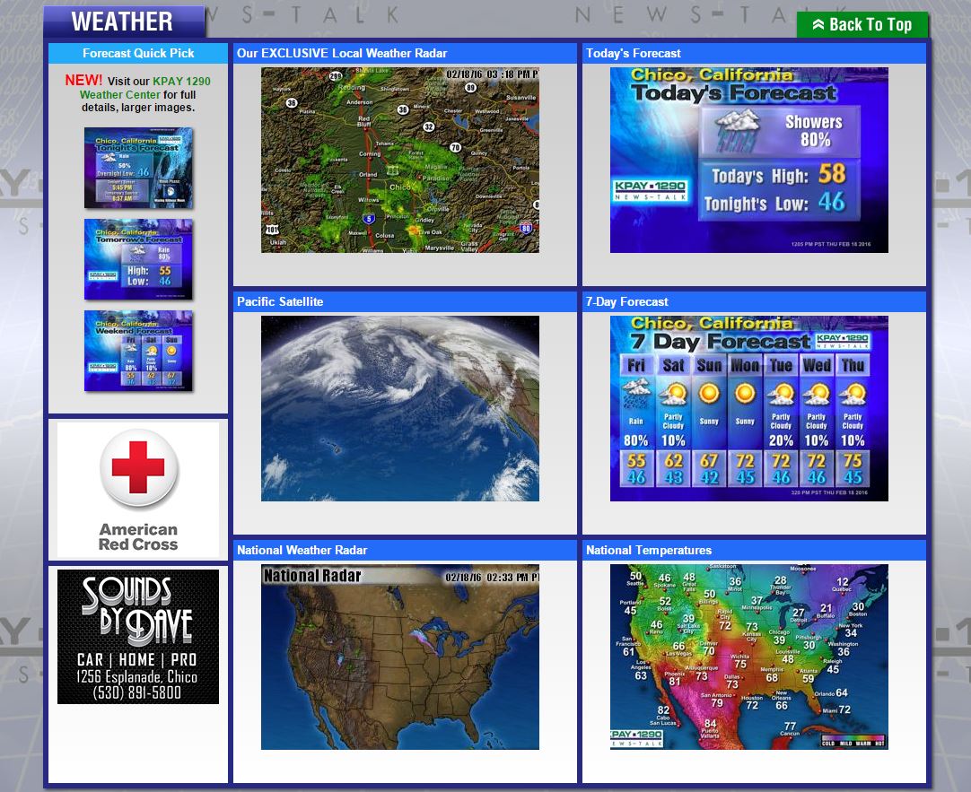
Here is an example of a radio station using our imagery inline on their web page:
For broadcast delivery, imagery is retrieved by our exclusive synchronization software running on our MediaServer 4000 or MediaServer HD video server and placed in the appropriate folders for playback. This runs entirely in the background so that on-air content is always as up-to-date as possible.